Story time
The Last Cartographer
Listen to Story
Gentle bedtime narration with natural pauses.
Ready for a cozy story time.
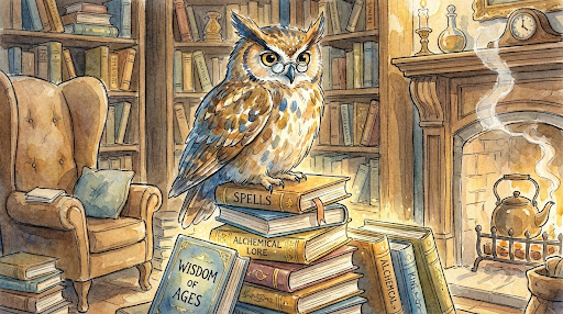
The Linden Institute had twelve students and three teachers, a building that smelled of ink and old paper, and a reputation in cartographic circles as either the last outpost of something valuable or the most elaborate exercise in nostalgia since people started making their own butter.
Felix had been there since he was fourteen. His mother — a geography professor who understood things about the relationship between humans and space that most people did not — had found it and pointed him toward it with the specific certainty of someone who knows their child before their child knows themselves.
"You should go," she'd said, the spring he was thirteen.
"It's two hundred miles away," he said.
"Yes," she said.
"And they teach drawing maps. By hand."
"Yes."
"Nobody does that."
"That," his mother said, "is exactly why."
What Felix learned at Linden:
He learned to read a landscape — to walk it and watch it and notice the things that don't show up on satellite imagery: the way a slope feels underfoot compared to how it looks from above, the way wind behaves in a valley, the places where people naturally gather because the ground is firm and the sight lines are clear.
He learned to draw: precisely, expressively, functionally. A map, his teacher Dr. Vasquez said, is not a photograph. It is an argument — a set of decisions about what matters and what doesn't. A photograph shows everything. A map shows what you think is true.
He learned about scale and projection and the ancient problem of representing a curved world on a flat page, and all the interesting ways humans had tried to solve it over three thousand years.
He learned that a map drawn by someone who has walked the land is different from a map drawn from satellite data — not better, necessarily, but different in quality. Like the difference between a recipe made by someone who loves the dish and one generated by an algorithm that has processed ten thousand recipes and produced an average.
He learned that he loved this.
Not as a hobby. Not as a curiosity. As the thing he was for.
The Cascade happened in the spring of his second year.
A geomagnetic storm — larger than the Carrington Event of 1859, the largest on record — hit without adequate warning on a Tuesday afternoon in April. Within forty-eight hours, the majority of Earth's satellite infrastructure was damaged or destroyed. Ground-based systems dependent on satellite synchronisation failed in cascading sequence. The global positioning network — which underlay not just navigation but enormous amounts of logistics, finance, and communications infrastructure — went dark.
The news was careful to say this was temporary.
The experts were honest that "temporary" might mean months.
The cities adapted with difficulty. Supply chains that relied on routing algorithms. Delivery systems. Emergency services.
The countryside adapted with greater difficulty. The farming regions, the mountain areas, the river valleys — places where roads were poorly signed because the assumption had been, for fifteen years, that everyone navigated by device.
Felix heard about it on the radio in his dormitory — a battery-powered radio, because Linden had a policy of analogue fallback for exactly this kind of situation, which his classmates had always found slightly paranoid and which now seemed, unanimously, farsighted.
Dr. Vasquez appeared in the common room at six in the morning.
"The region," she said, "needs maps."
They split into teams.
There were twelve students. There were six districts in the immediate region — valleys, villages, the mountain road that connected the northern settlements to the main town, the river route that was the only reliable alternative to the mountain road in bad weather.
Felix and two classmates — Amara and Deshi — took the mountain road.
They walked it in two days.
Felix had his field kit: a compass, a clinometer for measuring slopes, a notebook with graph paper, and three grades of mapping pen. He had walked parts of this road before, in exercises. He had never walked it with the particular urgency of this matters, now, to specific people.
They measured distances with a calibrated wheel they took turns pushing. They marked junctions, gradients, landmarks visible from the road in each direction. They noted where the road surface changed, where it narrowed, where the verge was solid and where it dropped away. They noted the springs — three of them — where water was available.
At the end of the second day, Felix sat in a barn lent to them by a farmer whose navigation system had been giving him nonsense coordinates for three days, and he spread his field notes on the hay bales and began to draw.
He drew for six hours.
When he was done, the map was not perfect. It was not precise to the metre. It had errors that a satellite image would not have had.
It also had things a satellite image would not have had.
It had the spring marked with a note: reliable water source, tested March this year, good for human consumption. It had the narrowing marked: single vehicle only, 200m, visibility poor — sound horn on approach. It had a note at the bottom of the steepest section: ice risk in cold weather — road turns east here and loses afternoon sun.
These were not things you could see from space.
These were things you learned by walking.
The farmer's name was Berndt. He sat next to Felix while he drew and watched without speaking, the way people who know what they're watching sit with it.
"You learned this?" he said, eventually.
"Yes," said Felix.
"Where?"
"There's a school."
Berndt looked at the map. He put his finger on a point near his own property — a crossroads that Felix had marked with careful detail.
"This junction," he said. "Nobody ever gets it right. The road that looks like the main road is actually the smaller one. The sat-navs always got it wrong until you corrected them manually."
Felix looked at his own map.
He had it right. He had seen the crossroads and looked at it — really looked — and understood instinctively which road bore the greater traffic.
"Your map," said Berndt, "has it right."
Felix looked at it for a long time.
He thought about Dr. Vasquez saying: a map is an argument about what matters. He thought about what it meant to have looked at that crossroads and made the right argument.
He thought: This is what I learned to do. And it is not nothing.
The Cascade was fully resolved in eleven weeks. New satellites were launched; ground infrastructure was restored; the global positioning network came back, region by region, like lights coming on in a city after a power cut.
The maps Felix and his classmates had made were retired from active use within a month of the networks coming back. They were stored in the regional archive. Perhaps they would never be needed again.
Perhaps they would.
At the end of the spring term, Dr. Vasquez took the twelve of them to a hill above the valley — the same hill Felix had used as a reference point in drawing the mountain road map — and they stood looking at the region spread below them.
"You know this place now," she said. "Not the way the satellite knows it. The way it wants to be known."
Felix looked at the valley. He could see the crossroads from here — Berndt's crossroads, the one the sat-nav always got wrong. He could see the river, the three springs, the way the road followed the natural ridge line up to the mountain pass.
"What do we do now?" Amara asked. "Go back to a world that doesn't need us?"
"The world has always needed people who see it properly," said Dr. Vasquez. "The world occasionally needs to be reminded of this." She paused. "The rest of the time, you do the seeing anyway. Because that is what you are."
Felix looked at the valley.
He thought: I know what's there. I know where the water is and where the road narrows and which junction looks wrong but isn't.
He thought: Even if no one ever needs a hand-drawn map again — I still walked this land. I still looked. I still understood something about it that the satellites will never put into words.
He thought: That is worth something. Even when no one is watching.
He picked up his pen and opened his notebook.
Below them, the valley waited in the afternoon light.
He began to draw.
The End.